Scarborough: They Called it Owascoag
Text by Mary B. Pickard
Images from Scarborough Historical Society, Rodney Laughton, the Scarborough Marsh Nature Center and Broadturn Farm
Unlike many neighboring towns, Scarborough did not develop around a town center. Scarborough's extensive salt marsh and rivers served as boundaries separating settlements that sprang up around their perimeters. Settlements didn't begin to move inland from the rivers and seacoast until after roads were developed in the early 1800s. Even though incorporated as a town in 1658, residents still identified themselves as being from Dunstan, Oak Hill, Pine Point or other neighborhood until the 1990s. Rapid development started in the 1970s, as people from other areas were attracted to Scarborough's abundant land and unique location.
Beginnings (pre-1631)
Long before European settlement, the Sokokis Indians lived in what we know as Scarborough. They called it Owascoag, "land of much grass," because of the extensive salt marsh. Fish, shellfish and wildlife of the marsh provided food, a medium of exchange and fertilizer for crops. Evidence of these earlier people can be found in a river of the marsh at low tide where there are exposed outlines of a fish weir used for trapping fish and in the shell heaps of Winnocks Neck.
European settlement along the Maine coast was an accidental by-product of the pursuit of fish. Early 1600s ships' logs had accounts of fishing and fur trading along the coast. Fish, particularly cod, was abundant and a very profitable commodity in Europe. Dried on fish stages and salted, cod kept for many months and was easy to transport. Space for fish stages and wood to build them were needed and were plentiful along the Maine coast. Territory for fish stages was allotted on a first-come first-served basis, and ships' captains soon realized the advantages of having "caretakers" remain at the end of a fishing season to maintain ownership of desirable space.
The first known European settler in Scarborough was John Stratton, who prior to 1631 established a year-round fish stage and trading post on islands about three miles off shore. Stratton and his companions traded with Indians and the fishing fleets that visited the Maine coast. In the Cammock Patent of 1631, the islands were referred to as Stratton's, or Stratton's Plantation, and one of the islands still bears his name. Originally, the islands and the mainland were known as Stratton's Plantation.
Settlement (1631-1674)
Captain Thomas Cammock was the first legal proprietor of land within the town. In 1631 the Council for New England granted Cammock the Patent of Black Point, 1500 acres from the Spurwink to the Black Point River, back one mile from the sea and including Stratton's Islands. Cammock arrived in 1633 from Piscataqua, where he'd been the agent of Mason and Gorges. He claimed all rights to fishing and "fowling" and apportioned land to tenants from whom he collected fees and rents. The original Cammock house was built on the headland now known as Prouts Neck. Friend Henry Jocelyn joined Cammock and his wife, Margaret, in 1635 and another house was built above Ferry Rock at the mouth of the Black Point or Scarborough River.

Alger Deed
A second settlement was established across the river at Blue Point in 1636. A year before Cammock's patent had been granted, the Council for New England granted Thomas Lewis and Captain Richard Bonython a four-mile-wide tract of land extending eastward from the mouth of the Saco River and eight miles inland. In return Lewis and Bonython agreed to transport fifty persons within seven years to settle on their land. Colonists Richard Foxwell and Henry Watts settled at Blue Point, assuming they were within the bounds of the Lewis and Bonython patent. When the bounds of the patent were surveyed, it was discovered that Foxwell and Watts had instead settled within what was then called Black Point.
In 1651 another settlement was established about three miles up river on a 1,000-acre tract of land owned by the Alger brothers. Andrew and Arthur Alger, part of Stratton's group, had moved ashore and purchased the tract from the heirs of Wackwarreska, Sagamore of Owascoag. Tradition says the purchase price was a bushel of beans down and a bushel of corn yearly. One condition of the sale was that Wackwarreska's daughter, Uphannum (known as Indian Jane or Jane Hannup), and her mother Nagasqua, be allowed to live on the land. The settlement was named Dunstan, a corruption of the name Dunster, the Algers' home in England.
The question of title to the territory encompassing these settlements was confused, because the Council for New England had granted several companies portions of the same territory from the Piscataqua to the Penobscot. After reviewing its charter, Massachusetts appealed to the English Chancery Court, claiming the territory rightfully belonged to her. Massachusetts then claimed the southern Maine settlements as her own; and after initial opposition, most settlements capitulated. Henry Jocelyn and other residents resisted for five years, but finally signed an Act of Submission in July 1658 and the town was incorporated as Scarborough. The town included lands formerly called Black Point, Blue Point and Stratton's Island and extended eight miles inland from the sea. The settlements may have been legally united, but they remained as essentially separate entities. An old record book of Scarborough has no entry until 1669, eleven years after incorporation.
Conflict/Abandonment/Resettlement (1675-1702)
The first Indian attack occurred September 1675 in the upper part of Blue Point at the home of Robert Nichols and his wife. The Nichols were murdered and their house burned. The following month Indians attacked the Algers' garrison house in Dunstan and, failing to capture it, burned empty houses and killed both Alger brothers. Scarborough, a town of three settlements of over one hundred houses and 1,000 cattle, had been destroyed.
In 1676 Mogg Heigon and about one hundred followers made an unsuccessful attack on the Black Point garrison. Mogg proposed to Jocelyn that if the garrison were surrendered, the settlers could leave safely. By the time Jocelyn returned to the garrison, all but his own family had left in boats. Jocelyn surrendered the garrison and was briefly held captive.
Most of the inhabitants returned in early 1677. The Black Point garrison, which had not been destroyed, was under the command of Lieutenant Tippen. In May Mogg Heigon and his men returned and began an assault on the garrison. Mogg was killed and his men withdrew, only to return the next month to avenge their leader's death. A group of nearly one hundred men led by Captain Benjamin Swett and Lieutenant Richardson were drawn into ambush and a bloody battle ensued in the vicinity of Moore's Brook, about two miles from the garrison. Swett and Richardson were killed and less then a half dozen men returned to the garrison without injury. There was a peace treaty with the Indians the next year, but the settlers were aware that an outbreak of hostilities could occur at any moment.
In 1681 a second garrison was erected at Black Point about a half mile north of Great Pond (later known as Massacre Pond), because the "neck" was too far away to be accessible to the settlers in time of trouble. Troubled peace broke into open hostility again in 1690 when the French in eastern Maine joined forces with the Indians and destroyed the settlement of Falmouth. Anticipating enemy advance on Scarborough, the settlers fled to Portsmouth and beyond and town records were taken to Boston, where they remained until 1720. It would be twelve years before settlers returned to Scarborough.
The Eighteenth Century
Resettlement occurred in the fall of 1702 when eight men, likely accompanied by their families, sailed from Lynn to Black Point. While a new fort was built at the western side of Garrison Cove, the settlers lived aboard their ship. The following August they were besieged by five hundred French and their Indian allies led by Beaubasin. The settlers refused to surrender the garrison, so the French tried to undermine it by tunneling underneath from the bank below. Heavy rain caused the soil to give way and the exposed workers abandoned their effort under fire from the men in the garrison. Despite continued skirmishes with the Indians, the second settlement continued to grow.
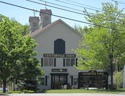
After resettlement, the center of activity shifted from Black Point to Dunstan. Until the mid-1800s, Dunstan was an important shipping and trade port. It was here that Richard King settled in 1746 and Dr. Robert Southgate in 1771. King was a distinguished citizen, merchant, farmer, and ship builder. Three of his children became major public figures. Rufus represented New York in the United States Senate; and as a senator, worked on the Missouri Compromise that permitted Maine to enter the Union as a free state. Cyrus, a jurist and orator, served two terms in Congress and William led the movement to separate Maine from Massachusetts, subsequently becoming Maine's first governor.
Per family tradition, Dr. Southgate rode into Dunstan on horseback, with all of his possessions in his saddlebags. Two years later he married Mary King, daughter of Richard King. Trained as a physician, Dr. Southgate left the practice of medicine to become a lawyer, judge and gentleman farmer. The large home he built overlooking the marsh on what is now Route 1 still stands.
When the British attacked Lexington in April 1775, the Provincial Congress issued a call for 13,600 men; militia from Scarborough and neighboring towns immediately responded. Two months later what is presumed the first naval battle of the Revolution occurred in Machias when townspeople fired on the British schooner Margaretta, killing the commander and forcing its surrender. Many townspeople were former Scarborough residents who discovered the area in 1762 while searching for grass for their animals following severe drought. Although Scarborough never suffered a direct attack from the British, many from the town played an active role in the struggle for independence.
After the Revolution, Maine was again the new frontier. While some veterans used government-backed grants to claim land elsewhere in the state, others remained and pushed outward to North Scarborough. Shipbuilding, farming, fisheries and sawmills offered opportunities.
The Nineteenth Century
Well into the early 1900s salt hay was a source of income for owners of marsh acreage. To increase yield and thus profits, large-scale diking was introduced and by the late 1800s five different diking companies had become involved. However, diking and development of roads and rail lines across the marsh negatively impacted the marsh, destroying soils and natural vegetation. As haying on the marsh declined, cleared inland pastures supplied that need.
A lack of good overland routes resulted in Scarborough remaining a town of separate villages, each with its own church and school. Dunstan and Portland were connected by a road inland from the marsh that went up a steep incline and over Scottow's Hill, but the hill was so steep horses had to be switched at the top to complete the journey. In 1802 the Scarborough Turnpike Corporation, headed by Robert Southgate and brothers William and Cyrus King, built the Cumberland Turnpike, the first turnpike in New England. It crossed the marsh between Dunstan and Oak Hill, the current path of Route 1, and was funded by toll rates, eight cents for a horse and twenty-five cents for a stagecoach. Objecting to the twenty-five cent tariff to cross the marsh, stagecoach owner Josiah Paine laid out a direct road from Dunstan to Stroudwater. This is the Payne Road of today.
The War of 1812 served as an impetus toward Maine's path to statehood. Opposing President Madison's declaration of war on Great Britain, Governor Strong would not allow the Massachusetts militia to leave the state and refused to contribute funds to pay them. Maine was left vulnerable with unprotected seaports. Madison nationalized part of the Massachusetts militia and put it under the command of William King. Hearing of King's command, many from Maine volunteered for service under him. Defense of local coastlines and communities was left to town militias. The Treaty of Ghent ended the war in December 1814, but the action (or inaction) of Governor Strong alienated Mainers who began to call for separation from Massachusetts. Maine finally achieved statehood in 1820, in part through efforts of Rufus and William King.
Travel was mainly by foot, horseback, boat or stagecoach until the mid-1800 arrival of trains. In 1842 the Eastern Railroad built a line connecting Boston and Portland, passing through Scarborough; and in 1853 the Grand Trunk Railroad was completed, linking Montreal to Portland. Improvements in transportation not only benefited townspeople by bringing trade and jobs to Scarborough, but also spawned the tourism industry. By the 1870s, sixty-five trains a day transported passengers and freight in and out of Portland and through Scarborough.
The Twentieth Century
By 1902 Scarborough had electricity, and electric cars (trolleys) replaced horsecars. There was great excitement that July when the rails of the Biddeford and Saco Railroad Company were finally connected to those of the Portland Railroad Company, connecting South Portland to Saco and providing trolley service through Scarborough. In the heyday of the trolley, one could travel south as far as Philadelphia or north to Bangor and beyond using connecting lines. By the late 1920s rising costs and declining business caused the phasing out of the trolleys. The last trolley ran through Scarborough in 1932.
As use of trolleys declined, use of automobiles became more widespread. Automobiles had begun to appear in Scarborough in the early 1900s, but road conditions were so poor that use was essentially seasonal. Even as roads began to improve in the 1930s, farmers would keep a horse and wagon as backup.
Aviation fever came to Scarborough in 1926 when Chester Jordan and Phillips Payson purchased land for an airport off Manson Libby Road. Construction began in 1927 and was completed in September 1928. During its period of operation, famous people who landed at the Scarborough airport were Charles Lindbergh, Amelia Earhart and Wiley Post. Within ten years, the airport became inadequate for the increasingly larger and more powerful aircraft and airport operations moved to Stroudwater. The Scarborough complex became a flying school and air show site, but it shut down completely in the 1950s. The site is now home to the Scarborough Industrial Park. A second airport, the Port-of-Maine Airport, opened after World War II at a site off Pleasant Hill Road. Service operations and flying schools operated at Port-of-Maine until the 1960s.
Trolleys, trains and automobiles brought tourists to Scarborough. Shore dinner places, such as the Dunscroft and Wayland, tourist cabins and lodging houses attracted motorists; and large guest hotels on the coast, such as the Checkley and Atlantic House, lured tourists who often arrived by train from Boston, New York, Montreal and beyond. Set back on Route 1 not far from the Willowdale area was the Danish Village, an authentic copy of the Danish village Ribe. It was a unique, one-hundred-unit pre-motel, a connected series of units that would later be typical of the modern motel. It ceased operation as a motor court with the advent of World War II and gas rationing, and the Government converted the units to housing for South Portland shipyard workers.
During World War II, Scarborough residents were involved on the warfront as well as the homefront. At home some worked on Liberty ships at the shipyard in South Portland. Frances Libbey, a Scarborough teacher, wrote to local servicemen and women--well over one hundred. Her chatty letters full of local news provided a valuable link to home. A group of civilians known as the Ground Observer Corps watched the skies for enemy aircraft and then again during the Cold War of the 1950s. The organization disbanded by 1959 when advanced radar systems made the Ground Observer Corps obsolete.
The 1950s brought change as veterans returned home, married, built houses and became involved in the community. The Maine Turnpike opened in 1948, bringing business to Scarborough. Population grew as people moved to town to fill jobs created by commercial growth. Although an era of peace, conflicts in Korea and Vietnam involved Scarborough men and women. The 1960s and 1970s were a traumatic time, as increased use of television brought world events into everyone's living room: the assassination of President Kennedy; the civil rights movement; the equal rights movement for women; Neil Armstrong's walk on the moon; and the continuing Viet Nam struggle.

During the last two decades, Scarborough continued to grow. Housing developments sprang up; large retailers Wal-Mart and Sam's Club came to town; Maine Medical Center broke ground for a complex of medical offices and lab, and the town built new support services for the burgeoning population. Fortunately, some Scarborough residents realized the need to protect the natural resources that had attracted people to the town. Two groups, the Scarborough Land Conservation Trust and the Friends of the Scarborough Marsh, formed to safeguard the town's open space, marshland and nature trails for future generations.
The Twenty-First Century

Residential and commercial growth has continued into the present century. Scarborough is no longer the small town it was in the mid-1900s; it is one of the fastest growing communities in Maine. Its small-town character, proximity to Portland and Boston, excellent schools, abundant undeveloped land and easy access to mountains and the sea are factors that have attracted families and businesses. Realizing the impact of growth on services and the neighborhood "feel" of Scarborough, in 2002/2003 the town initiated a series of neighborhood meetings to solicit citizen input prior to the 2006 Comprehensive Plan Update. It is anticipated that the Comprehensive Plan will serve as a blueprint for controlled growth and preservation of natural resources while maintaining Scarborough's small-town character.

Bibliography
Acts and Resolves Passed by the General Court of Massachusetts. "An Act for Establishing a Turnpike Corporation Within the Town of Scarborough." Chapter 34,1802.
Chapman, Leonard B. Monograph on the Southgate Family of Scarborough, Maine. Portland, ME: Hubbard W. Bryant, 1907.
Chase, Georgiana. Stratton's Islands of Saco Bay, An Interwoven History 1605-1993. Fort Bragg, CA: Mendocino Lithographers.
Gold, Susan Dudley, ed. Scarborough at 350: Linking the Past to the Present. Scarborough, ME: Friends of the Scarborough 350th, 2007
Holland, Rupert Sargent. The Story of Prouts Neck. Prouts Neck, ME: Prouts Neck Association, 1924.
Jones, Herbert G. The King's Highway from Portland to Kittery. Portland, ME: Longfellow Press, 1953.
Karr, Paul and Jeff Clark. "Oasis of Wilderness." Down East Magazine, September, 1995.
Leamon, James S. Revolution Downeast: The War for American Independence in Maine. Amherst, MA: The University of Massachusetts Press, 1993.
Libbey, Dorothy Shaw. Scarborough Becomes a Town . Freeport, ME: The Bond Wheelwright Co., 1955.
Moulton, Augustus. Grandfather Tales of Scarborough . Portland, ME: Katahdin Publishing Co., 1925.
Moulton, Augustus. Old Prouts Neck. Portland, ME: Marks Printing House, 1924.
Paine, Lincoln P. Down East: A Maritime History of Maine . Gardiner, ME: Tillbury House, 2000.
Scarboro Register, 1905. Compiled by Mitchell & Campbell. Brunswick, ME: H.E. Mitchell Co., 1905.
Snow, John O. Secrets of a Salt Marsh. Portland, ME: Gannett Books, 1986.
Southgate, William S. History of Scarborough from 1633 to 1853. Portland, ME, 1853.
Sylvester, Herbert Milton. The Sokoki Trail. Boston, MA: Stanhope Press, 1907.
Ware, Moses Weld. Beacon Light in the History of Prouts Neck. Prouts Neck, ME: Prouts Neck Association, n.d.
Woodard, Colin. The Lobster Coast: Rebels, Rusticators and the Struggle for a Forgotten Frontier. New York: Penguin Books, 2004.
York Deeds. Vol. II, 114.